
Canadian Maps
139 Maps
| Maps Home >> Historical Maps >> 1800's >> The Maritime Provinces, 1854 |
Image has been Resized!
 View Full Image
View Full Image
|
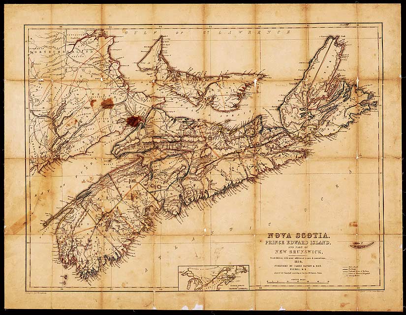
Description This is the third edition of this map published in Pictou, Nova Scotia, by James Dawson & Son. It was one of the first maps printed in Eastern Canada.
|
Posted Comments
No comments. Why don't you go ahead and post one!?
You want to post comments ? First you must Register!
Canada Kicks Ass!
Commented Pics
 Sex Flow Chart in Gender Humour
November 15th, 2020 by cobrass Divine Light in Gender Humour
November 15th, 2020 by cobrass Ash in Babe Wallpapers
August 15th, 2020 by Vanucx Maple Leaf Collage in Maple Leaf
October 12th, 2018 by homebound Another Chinese Toy Recall in Illusions
November 6th, 2016 by Hyack
